
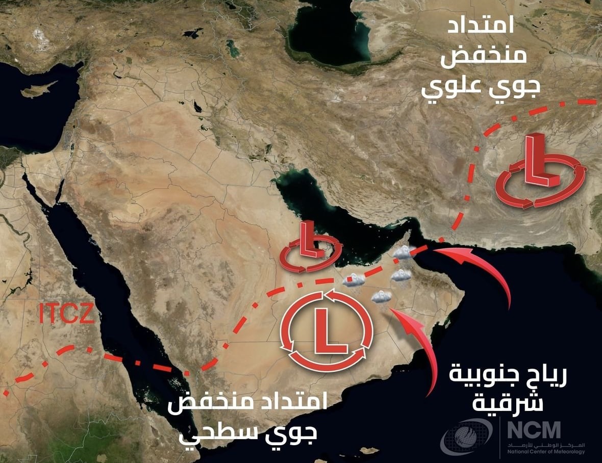
The National Centre of Meteorology has forecasted that from today until Friday, several eastern and southern regions of the country will experience the formation of local cumulonimbus clouds, particularly during the afternoon hours. This weather pattern is expected to bring varying intensities of rainfall, driven by the northward advance of the Inter-Tropical Convergence Zone (ITCZ), combined with an upper-level low system moving in from the east and a surface low extending from the south. Additionally, moisture will flow in from the Sea of Oman, coupled with rising temperatures influenced by the eastern mountains.
Weather Conditions and Visibility
The Centre reported that winds will shift from south-eastern to north-eastern directions, maintaining a moderate speed that may become active or occasionally strong, especially in the presence of cumulonimbus clouds. This may lead to the stirring up of dust and sand, which could result in reduced horizontal visibility.
Marine Conditions
Concerning maritime conditions, the seas will be characterised by light to moderate waves in both the Arabian Gulf and the Sea of Oman.

Stay updated with the latest local, sports, political, and economic news through Google News.