
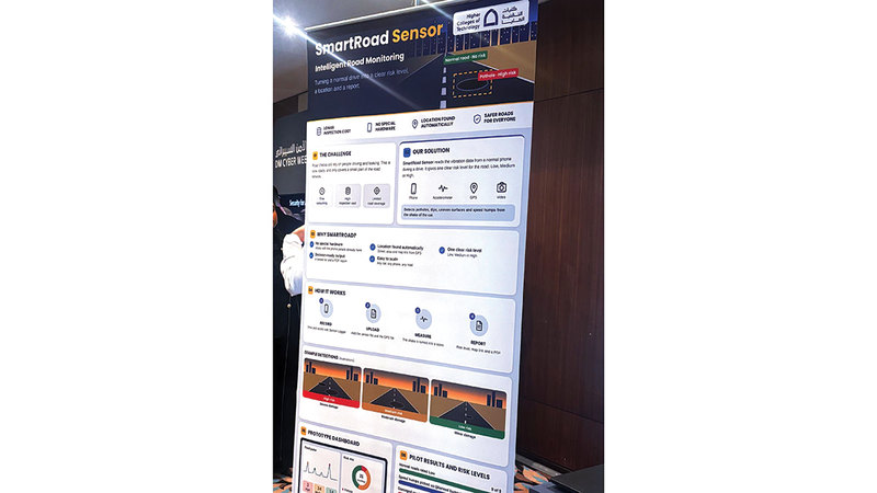
In a groundbreaking initiative, three students from the Higher Colleges of Technology in Dubai have introduced the “Smart Road Sensor” project, designed to enhance road monitoring and provide critical data that can help authorities prioritise inspection and maintenance. This effort aims to improve damage detection efficiency and bolster road user safety.
Utilising AI for Effective Road Monitoring
The project, conceived by Abdullah Al-Manaai, Mohammed Al-Zarouni, and Ahmed Al-Ali, was presented during the inaugural “Cybersecurity Week,” organised by Dubai Municipality under the theme “Towards a Secure Digital Municipality.” The initiative employs artificial intelligence to analyse vibration data collected from smartphones, evaluating the severity of potholes, bumps, depressions, and uneven surfaces on roads.
Innovative Use of Smartphones
Abdullah Al-Manaai explained to Emirates Today that the system processes vibration data captured by smartphones while driving, integrating this with geographic location data to monitor changes in road surfaces and assess their hazard levels. These are classified into three categories: low, medium, and high. This provides a preliminary indicator that helps identify areas needing inspection and maintenance.
Accessibility and Versatility
Ahmed Al-Ali highlighted that the project does not require specialised equipment, relying instead on smartphones and geographic location data to automatically pinpoint damage locations. It generates a list of observed sites along with a report of the evaluation results. The design allows for use across various types of vehicles, smartphones, and road conditions, making future application expansion feasible.
A Rigorous Testing Process
Mohammed Al-Zarouni detailed the operational mechanism of the “Smart Road Sensor.” The process begins with the collection of vibration data while driving using the “Sensor Logger” application. This data, alongside the geographical location file, is uploaded to the system. Following analysis, the vibrations are converted into numerical grades, classifying the hazard level and producing a report that includes the results of the assessment and a link to a map indicating the location of the damage.
Positive Initial Findings
To validate the system, the team gathered 31 actual recordings from various roads. The preliminary results classified normal road conditions as low hazard, successfully identifying planned bumps, while some damaged segments fell into the medium and high hazard categories. The team is continually working to enhance the accuracy of their results by collecting more data and refining the classification mechanism.
Contributing to Cybersecurity Awareness
The “Cybersecurity Week,” which spans three days, aligns with Global Cybersecurity Awareness Month, aiming to foster a culture of cybersecurity and information safety while raising awareness about the risks and threats in the cyber domain.